




Bathymetric Survey
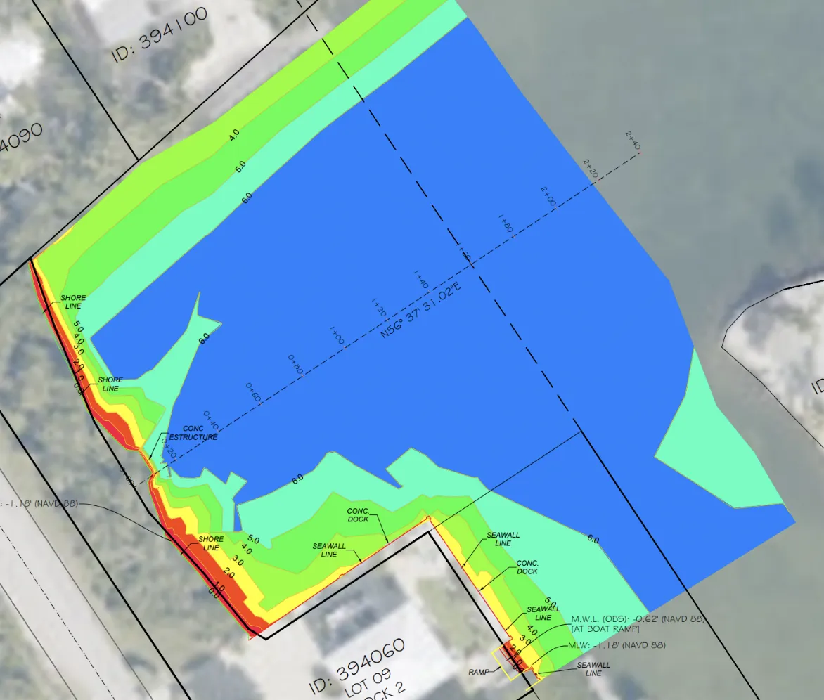
A bathymetric survey measures and maps the depth, shape, and underwater contours of lakes, canals, ponds, rivers, marinas, and other bodies of water. Using specialized surveying equipment, the survey can identify bottom elevations, sediment buildup, submerged features, and changes in the waterbed. Bathymetric surveys are commonly used for dredging design, dock and marina planning, shoreline improvements, environmental studies, volume calculations, and construction projects near or within the water.
What is a Bathymetric Survey?
Prefer to speak to a live human? Call our headquarters
(305) 328-9156
Who Needs a Bathymetric?
Bathymetric surveys are commonly needed by:
Property owners with waterfront land
Marinas and boatyards
Dock and seawall contractors
Civil engineers and land developers
Dredging companies
Environmental consultants
Municipalities and government agencies
Homeowners’ associations
Golf courses and communities with lakes or ponds
Utility and infrastructure contractors
Ports, harbors, and waterfront facilities
Attorneys or title professionals handling submerged land boundaries
These surveys are often required for dredging, dock construction, shoreline improvements, water-depth verification, sediment analysis, permitting, volume calculations, and underwater construction planning.
Please fill out this form with all the client information that is needing the Bathymetric completed. We do no need the name of the person filling this out.

©Copyright 2026. Apex One Inspections & Surveys. All Rights Reserved.
Power Up Your
Content Strategy
Unlock your brand's potential with our expert content marketing solutions.
Facebook
Instagram
Youtube
Mail
TikTok